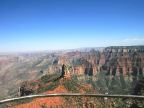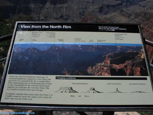
View from the North Rim
Below the rim lies an intricate landscape of
erosional landforms, shaped by water from rain
and snow but untouched by the Colorado River.
This on-going process of weathering and erosion
is also responsible for the network of tributary
canyons that feed into the Colorado River. The
river itself is invisible from this vantage.
Geologists estimate that it has taken less than 5 or
6 million years to carve the canyon and create the
landscape you see before you.
[Features in picture, left to right]
Angels Gate
Humphreys Peak
Distance 64 miles 103km
Elevation 12,633ft 3851m
Deva Temple
Brahma Temple
Distance 4.5 miles 7.3km
Elevation 7,553 ft 2302m
Zoroaster Temple
Red Butte
Distance 24.5 miles 39.4km
Yaki Point
Bright Angel Canyon
Grand Canyon Village (South Rim)
Distance 11 miles 17.7km
Elevation 6,860ft 2091m