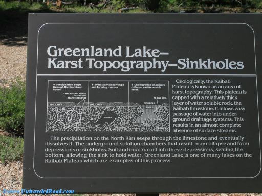
Greenland Lake—Karst Topography—Sinkholes
Geologically, the Kaibab
Plateau is known as an area of
karst topography. This plateau is
capped with a relatively thick
layer of water soluble rock, the
Kaibab limestone. It allows easy
passage of water into underground
drainage systems. This
results in an almost complete
absence of surface streams.
The precipitation on the North Rim seeps through the limestone and eventually
dissolves it. The underground solution chambers that result may collapse and form
depressions or sinkholes. Siol and mud run off into these depressions, sealing the
bottom, allowing the sink to hold water. Greenland Lake is one of many lakes on the
Kaibab Plateau which are examples of this process.