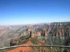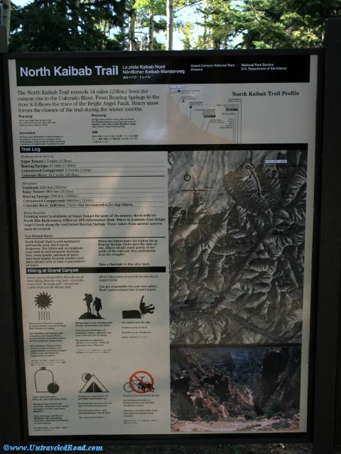
North Kaibab Trail
The North Kaibab Trail extends 14 miles (23 km) from the
canyon rim to the Colorado River. From Roaring Springs to the
river it follows the trace of the Bright Angel Fault. Heavy snow
forces the closure of the trail during the winter months.
Warning
Never try to hike from the rim to the
river and back in one day. Many who tried
suffered serious illness or death.
Distance from here to:
Supai Tunnel: 1.7 miles (2.7km)
Roaring Springs: 4.7 miles (7.6km)
Cottonwood Campground: 6.8 miles (11km)
Colorado River: 14.2 miles (22.9km)
Elevation:
Trailhead: 8250 feet (2515m)
Supai Tunnel: 6800 feet (2073m)
Roaring Springs: 5200 feet (1585m)
Cottonwood Campground: 4080 feet (1244m)
Colorado River: 2400 feet (732m) Not recommended for day hikers.
Water Sources:
Drinking water is available at Supai TUnnel for most of the season; check with the
North Rim Backcountry Office or NPS Information Desk. Water is available from Bright
Angel Creek along the trail below Roaring Springs. Water taken from natural sources must be treated.
You Should Know
North Kaibab Trail is well maintained
and heavily used. but it can be
dangerous. Day hikers and overnighters
must both be well prepared. Extreme
heat, steep grades, and lack of water
have been deadly. In warm weather each
hiker should carry at least 2 quarts/liters
of water.
Mules and hikers share the trail as far as
Roaring Springs. Mules have the right of
way. Hikers should stand quietly to the
inside of the trail and obey instructions
from the wranglers.
Take a flashlight to hike after dark.